Rignano Flaminio (Rignano Flaminio)
Rignano Flaminio is a comune (municipality) in the Metropolitan City of Rome in the Italian region of Latium, about 35 km north of Rome. It is across the Via Flaminia.
Rignano Flaminio borders the municipalities of Calcata, Capena, Civitella San Paolo, Faleria, Magliano Romano, Morlupo, and Sant'Oreste.
It has a station on the Roma-Viterbo railway.
Agricultural settlements of the Capenati and Falisci in the area are attested from the 5th or 4th centuries BC. In the 6th century AD a popular pilgrimage church, entitled to St. Abondius and Abondantius, was created here; the saints' relics were moved to Rome, on the Tiber Island, in 999. In 1159 Pope Adrian IV died at Rignano.
Rignano was first a possession of Santa Maria in Trastevere and then of the Savelli family, who were shortly ousted by Pope Alexander VI. After the fall of the Borgia, the Savelli regained it and held the fief until 1607, when they sold it to the Borghese. It later passed to the Muti, the Cesi and the Massimo families.
Map - Rignano Flaminio (Rignano Flaminio)
Map
Country - Italy
 |
 |
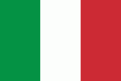
| Flag of Italy | |
Italy was the native place of many civilizations such as the Italic peoples and the Etruscans, while due to its central geographic location in Southern Europe and the Mediterranean, the country has also historically been home to myriad peoples and cultures, who immigrated to the peninsula throughout history. The Latins, native of central Italy, formed the Roman Kingdom in the 8th century BC, which eventually became a republic with a government of the Senate and the People. The Roman Republic initially conquered and assimilated its neighbours on the Italian peninsula, eventually expanding and conquering a large part of Europe, North Africa and Western Asia. By the first century BC, the Roman Empire emerged as the dominant power in the Mediterranean Basin and became a leading cultural, political and religious centre, inaugurating the Pax Romana, a period of more than 200 years during which Italy's law, technology, economy, art, and literature developed.
Currency / Language
| ISO | Currency | Symbol | Significant figures |
|---|---|---|---|
| EUR | Euro | € | 2 |
| ISO | Language |
|---|---|
| CA | Catalan language |
| CO | Corsican language |
| FR | French language |
| DE | German language |
| IT | Italian language |
| SC | Sardinian language |
| SL | Slovene language |


